PUFF モデル によるシベリア森林火災のシミュレーション
Real-time forest fire prediction (demonstration)
for an arbitrary fire in Siberia
using the PUFF model.
学術目的以外でのご使用は堅くお断りします。
No use other than academic purpose
日本時間はこれに9時間たしてください。
Forest Fire in Record at Siberia: (Satellite image is provided by Dr. Fukuda)
![]() Satellite
Satellite
Forest fire at Siberia (113, 53) starting from 00Z 18 May 2003.
![]() Satellite
Satellite
![]() PUFF Model
PUFF Model
![]() X-Y map
X-Y map
![]() 3-D map
3-D map
Forest fire at Far East (131, 47) starting from 00Z 18 May 2003.
![]() Satellite
Satellite
![]() PUFF Model
PUFF Model
![]() X-Y map
X-Y map
![]() 3-D map
3-D map
Forest fire at Far East (132, 48) starting from 00Z 14 Oct 2004.
![]() Satellite
Satellite
![]() PUFF Model
PUFF Model
![]() X-Y map
X-Y map
![]() 3-D map
3-D map
|
|
| Simulation Time: | Starting UTC time indicated in figures. |
|---|---|
| Smoke Height: | 2000 m (6000 feet) assumed |
| Duration: | Continuous fire assumed |
| Simulated by: | PUFF Model at the University of Tsukuba |
| PI and CI: | H.L. Tanaka |
| Supported by: | PUFF Project under INIS/IARC/NASDA |
| Upper Air Data: | GPV/JMA Predicted wind (GSM) |
| Output Interval: | Every six hour |
| Output (1): | Smoke distribution (x-y) Animation |
| Output (2): | Smoke distribution (x-z) |
| Output (3): | Smoke distribution (y-z) |
| Output (4): | Smoke distribution (3-d) |
| Output (5): | 500 hPa height at 12 UTC |
Plume distribution (x-y) Animation
Plume distribution (x-z)
Plume distribution (y-z)
Smoke distribution (ash)
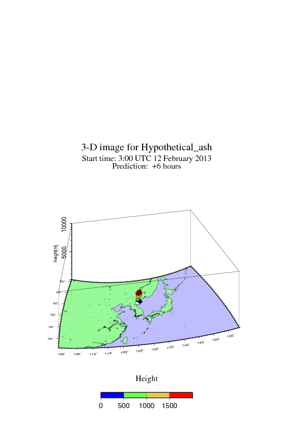
Smoke distribution (3-d)
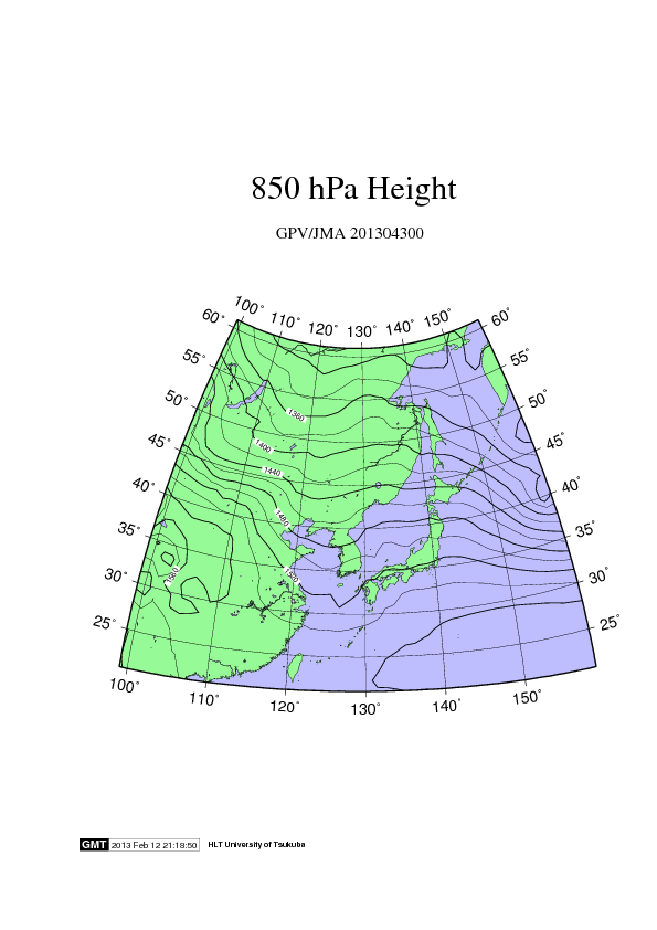
850 hPa height (x-y)